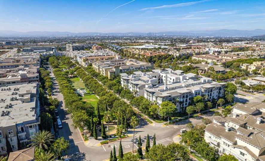
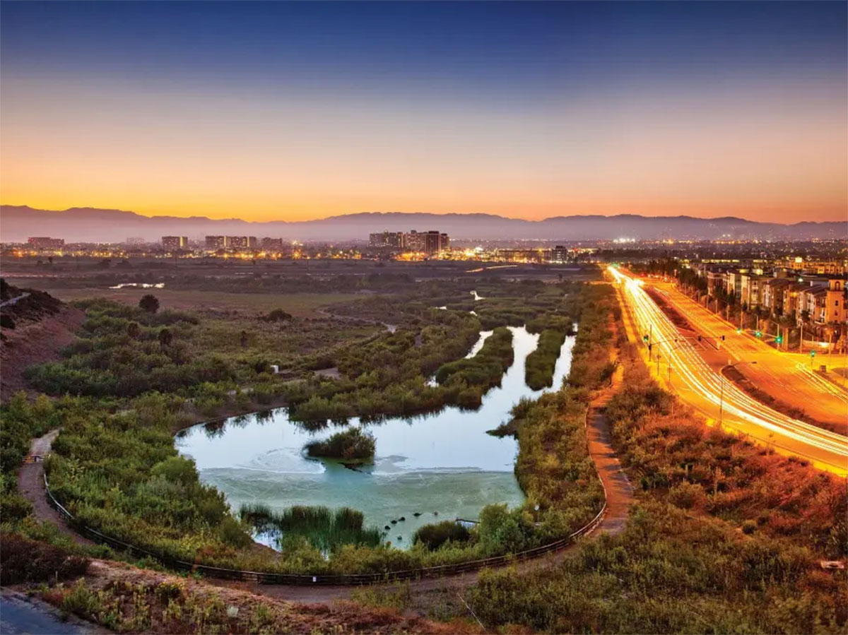
Aerial view of Playa Vista’s Crescent Park / Photo courtesy of MLS Realty
Playa Vista – “A Four Decade Overnight Success” Documentary
In 1989, DPZ began a planning project for Playa Vista, a Los Angeles development for the former Howard Hughes airport and aircraft facility. It has since become a successful, mixed-use community proud of its preservation of history and restoration of adjacent wetlands. In an effort to document its history, Playa Vista Institute has created an in-depth documentary detailing the story of its development.
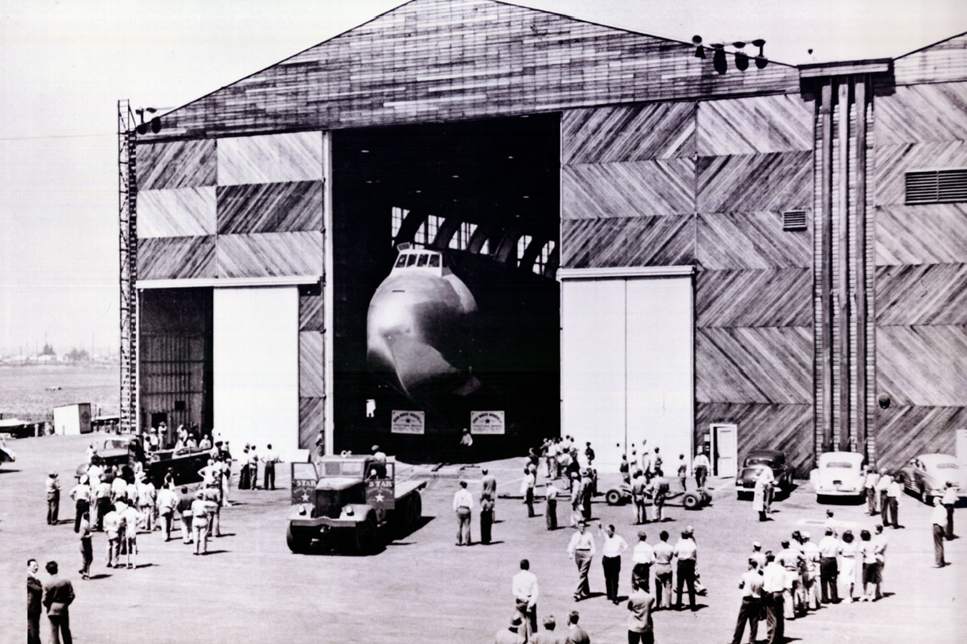
Historic image of the Hughes H-4 Hercules (aka the Spruce Goose) aircraft at a Hughes Airport hangar / Photo courtesy of Playa Vista Institute
The early days of Playa Vista’s development was accompanied by controversy. The Summa Corporation, the company that controlled the land and assets following the death of landowner Hughes, did not follow his wishes to leave the property undeveloped to preserve the Ballona Wetlands, historically occupied by the Gabrielinos/Tongva Native Americans. Summa’s plans for 6 million square feet of office space, high-rise buildings, and a million square-feet of retail space was met with public opposition in 1980 when it was announced.
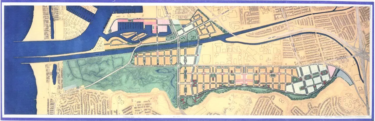
Playa Vista Master Plan / Photo courtesy of Playa Vista Institute
In 1989, McGuire Thomas Partners took over the project and invited DPZ to gather a team to design the master plan that produced the Playa Vista we know today. Among the team were DPZ colleagues in the New Urbanism: Moule & Polyzoides, Moore Ruble Yudell, and Laurie Olin (landscape architect).
The new plan shifted away from a focus on commercial development to a community with a mix of uses and a major dedication to the conservation of the wetlands — 200 acres more than the original 1980 plan. A freshwater marsh, a riparian corridor, and restoration fund were also included.
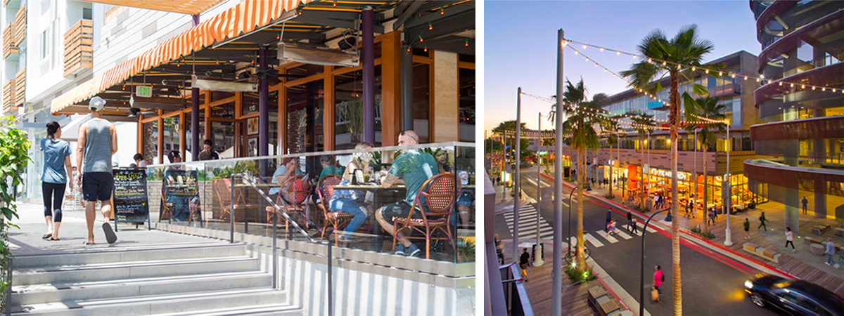
The active pedestrian realm at Playa Vista / Photo credits to Playa Vista
The fundamental component of the master plan is the residential neighborhood. Each neighborhood has a distinct character related to its location while also sharing common planning principles — highlighted by a street and block structure with frequent paths. The high-density, multi-family buildings are organized around courtyards according to Los Angeles traditions. The architecture gives streets strongly defined edges to encourage pedestrian activity and frames a series of greens and squares with neighborhood amenities like playgrounds.
The Ballona Wetlands / Photo courtesy of Playa Vista Institute