From Montava: An Innovative Intersection Plan
Montava is an ambitious project slated to fill many needs in Northeast Fort Collins, Colorado. Starting with a 2017 public charrette, the DPZ master plan was designed to guide the creation of a new town center that stitches together several existing neighborhoods and establishes a new model of growth to inspire Fort Collins’ few remaining large-parcel development areas. But it’s not just any development—Montava is pushing the envelope on pedestrian and bicycle-centric design, with networks of car-free paths and streets and serious traffic calming. One of the innovative techniques to slow down vehicular speeds was tested in a Fort Collins parking lot this fall. Click here to see the video.
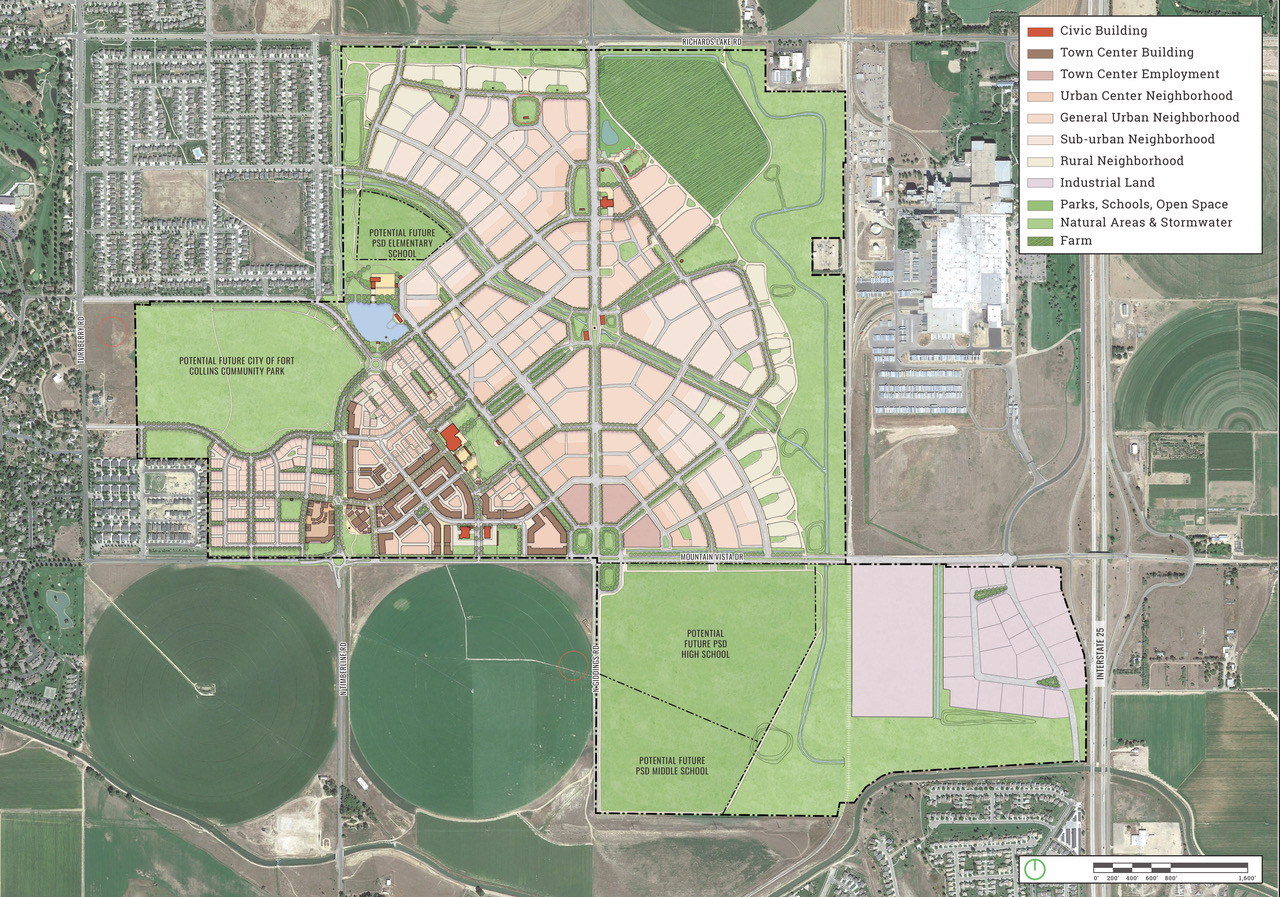
Mobility in this sector of the city has historically been challenging. Fragmented and disconnected by infrastructure and uncoordinated road networks, this area is located at the convergence of major and minor streets, trails, rail lines, and open space amenities. Montava will mend this disconnect and serve as a new center of activity with a wide range of uses, residential options, and open spaces. In addition to making roadways safer and more user-friendly, the design of Montava offers a robust mix of commercial, office, and entertainment that will enable future residents to access their daily needs with fewer car trips.
As a sign of commitment to a safer, more walkable environment in areas where car, bicycle and pedestrian traffic overlap, this past October the Montava client mocked up a dutch-inspired intersection that will be built along the extension of Timberline Road that will serve as Montava’s principal north-south spine. The aim is to significantly slow vehicles while facilitating substantial bicycle and pedestrian cross-movement.
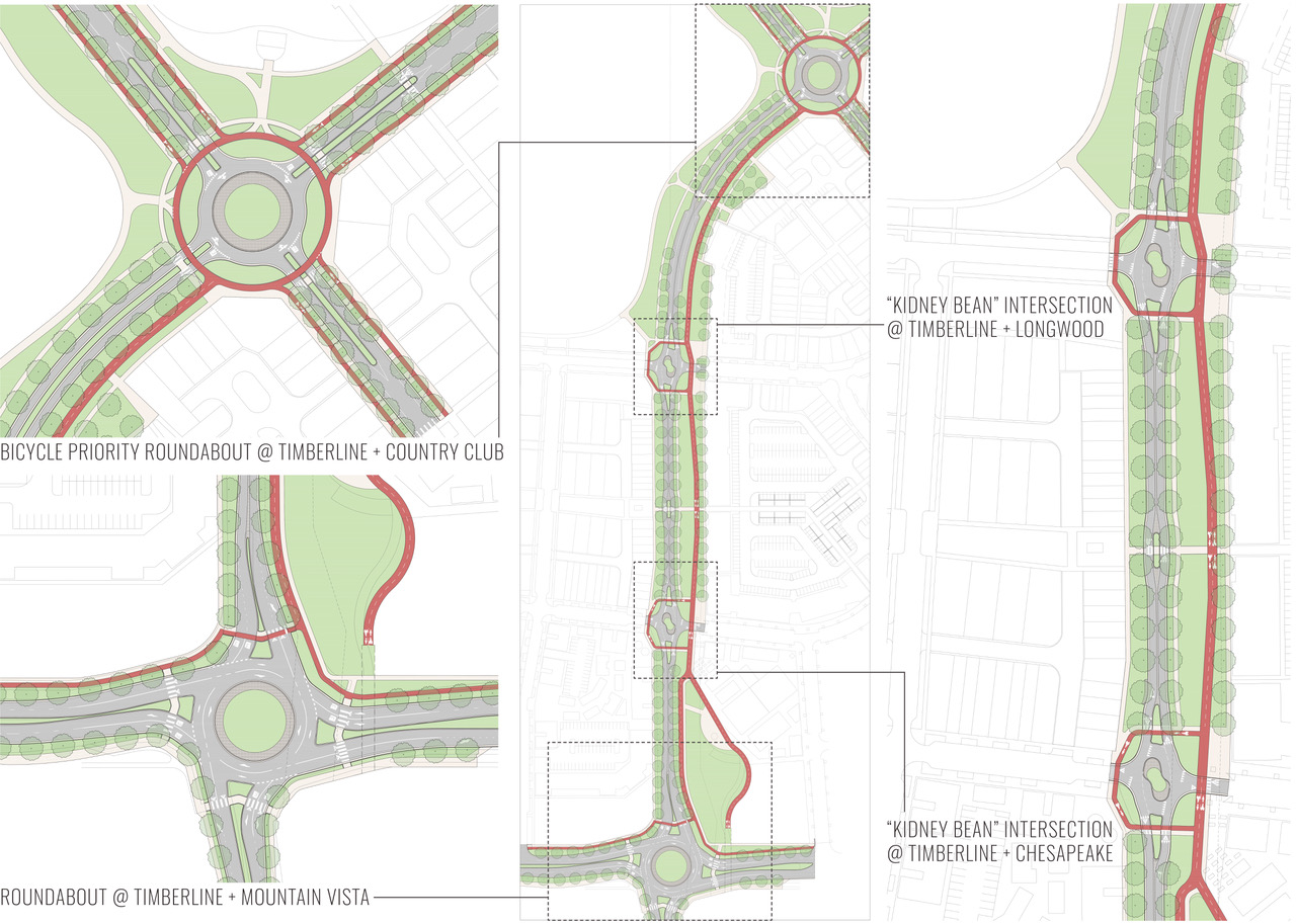
Traffic-calming infrastructure along Montava’s main boulevard, Timberline Road, works in concert with bicycle and pedestrian networks.
The feature, known as a “kidney-bean” intersection, was adapted from Dutch models. It provides left turn movements from a main street into a more substantial roadway. The structure will help to avoid excessive roadway width for turn lanes, making the resulting traffic experience more like an indirect left turn. The turn pockets can hold two cars and operate much like a roundabout, but the through lanes are slightly deflected to slow speeds.
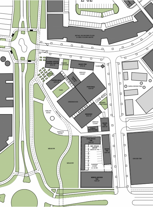
The southern “kidney bean” intersection will help accommodate access to the Town Center and the first phase neighborhood. There is a second intersection further north at a major, 80-acre city park. The city engineering and fire department had a myriad of concerns and questions that could never be sufficiently answered, so a mock-up was the logical way to test the efficiency.
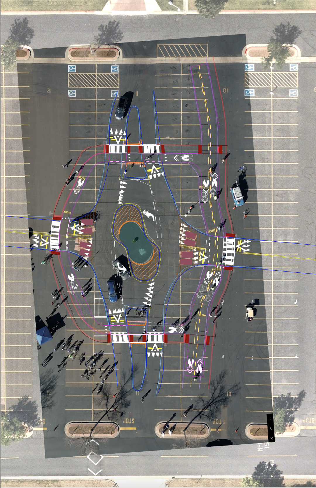
This “kidney bean” intersection, mocked-up in an area parking lot, allowed local officials to evaluate future Montava Town Center access by drivers, pedestrians, and cyclists.
Providing such a feature along this north extension of Timberline Road is an opportunity to rethink what a functionally classified roadway can deliver. The mocked-up “kidney bean” allowed both city departments to evaluate operations, drivers, pedestrians, and cyclists. Each demographic was able to weigh in on their experiences, making way for necessary tweaks in the plan.
The full-scale testing of innovative solutions is a key strategy for implementing change in central area traffic patterns. The Timberline extension will also include protected pedestrian and bicycle crossings as well as a Dutch-style bicycle priority round-about further north. These first two development phases are currently in the city’s approvals process with additional phases well into detailed development.